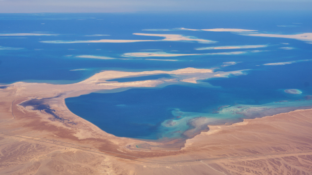
Parts of the Sahara Desert are turning green amid an influx of heavy rainfall
Written by ABC AUDIO ALL RIGHTS RESERVED on September 24, 2024

(NEW YORK) — One of the driest regions on earth is shifting green, as an influx of heavy rainfall causes vegetation to grow in the typically barren landscape.
Satellite images released by NASA show pockets of plant life popping up all over the Sahara Desert after an extratropical cyclone drenched a large swath of northwestern Africa on Sept. 7 and Sept. 8.
Treeless landscapes in Morocco, Algeria, Tunisia and Libya — areas that rarely receive rain — are now seeing traces of green sprouting up, according to the NASA Earth Observatory.
The plants include shrubs and trees in low-lying areas, like riverbeds, Sylwia Trzaska, a climate variability researcher at the Columbia Climate School, told ABC News.
It is not wholly unusual for the plant life to sprout in the Sahara when a deluge of rain pours in, past research has shown. When parched regions in this part of Africa get heavy rainfall, the flora responds almost readily, Peter de Menocal, president and director of the Woods Hole Oceanographic Institution, told ABC News.
“When you get these really exceptional rainfall events, the dunes become these just incredibly verdant and flowered fields where the plants will just instantly grow for a short period of time to take advantage of,” he said.
The region was once permanently home to lush greenery. Between 11,000 and 5,000 years ago, the Sahara was covered with vegetation and lakes, according to a 2012 paper authored by De Menocal.
“It looks like a desert, and then when the rain comes, then everything starts greening very quickly,” Trzaska said.
In addition, lakes that are typically empty are filling up due to the most recent event, Moshe Armon, a senior lecturer at the Institute of Earth Sciences and the Hebrew University of Jerusalem, said in a statement released by NASA.
Between 2000 and 2001, Sebkha el Melah, a salt flat in central Algeria, has only filled six times in the past, according to research conducted by Armon and his colleagues.
Preliminary satellite analysis shows rainfall accumulations topping half a foot in the areas affected, according to NASA. Some areas of the Sahara receive just a few inches of rain per year.
While some degree of rainfall every summer is normal due to the West African Monsoon season, it is unusual for the Intertropical Convergence Zone — or the tropical rain belt — to reach as far north as the Sahara, De Menocal said.
The northward displacement of the storm track helped a developing system dump a year’s worth of rainfall in some areas in just a matter of days, according to NASA. The system formed over the Atlantic Ocean and extended far southward, pulling moisture from equatorial Africa into the northern Sahara, according to NASA.
Since mid-July, the Intertropical Convergence Zone has been sending storms into the southern Sahara, according to the National Oceanic and Atmospheric Administration’s Climate Prediction Center.
About four million people across 14 African countries have been impacted by flooding, according to the World Food Programme.
Record-high ocean temperatures in the northern Atlantic ocean is contributing to the shift in the rain belt, bringing heavy rainfall typical of regions in the equator farther north, De Menocal said.
The transition from El Niño to La Niña likely affected how far north the Intertropical Convergence Zone moved, Trzaska said.
Climate change could cause the rain belt to shift farther northward in the future, according to a study published in Nature earlier this year. But as the ocean temperatures elsewhere in the world catch up to the Atlantic, the rain belt will likely shift back down, even south of the equator, De Menocal said.
“Decades from now, when the larger oceans have warmed more uniformly, we expect the rain belt to actually go back to its original position, and it can even shift into the other hemisphere,” he said.
The northward shift of the Intertropical Convergence Zone across West Africa has also likely contributed to a lull in tropical activity in the Atlantic Basin, according to experts.
Disturbances moving across this region are then entering the Atlantic over relatively cooler waters, Dan Harnos, a meteorologist at NOAA’s Climate Prediction Center, told ABC News last month. With greater exposure to dry air from the mid-latitudes, the chances of a storm developing are hindered.
Copyright © 2024, ABC Audio. All rights reserved.


